
Shedden Valley Walk
This was a sequel to the ‘Shedden Valley Mystery’ DVD viewing by Spaggers, on the first of June, in which the late Titus Thornber, the Cliviger Historian, explained the mysterious piles of stones that littered the whole of the Shedden Valley as debris from the recovery of limestone deposited by a glacier in the ‘recent’ Ice Age. 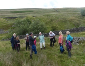 Ten Spaggers gathered at the exposed car park on the Long Causeway opposite the Coal Clough Windfarm, to be lead round the valley by David Thornber, Titus’ son, ably assisted by his cousin Frances Bland. David arrived at the car park in his 1932 Jowett car, in fine fettle.
After a brief briefing they set off down the path to the valley, initially through an area where there were man-made goyts and ponds to provide the water for the hushing, but, it must be admitted, were very difficult to discern. This part of the walk follows a numbered trail, inspired by Titus’ work, still available on-line. 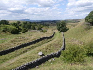 Next came a short stretch of the drove road through the later enclosures, leaving to the left down the path to a view spot (albeit the view now largely obscured by growth) with a display board still surviving after maybe 35 years. Here the colossal number of piles of stones can be readily seen that took some explaining. They were clearly not quarry debris, being more rounded, more like boulders from river beds. They were the rejected stone after removal of the limestone. All had been recovered from the hillsides by the water ‘hushing’ washing away the soil, silt, earth, to expose them.
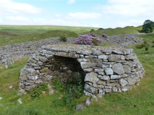 Onward down through the ‘tunnel’ between the prolific rhododendron bushes to a rebuilt lime kiln. This was rebuilt c1985, Titus says that he has found the site of fifty of these kilns dotted around the valley. Lime production here more or less ceased c1796 after the building of new large lime kilns in Burnley after the arrival of the Leeds and Liverpool Canal.
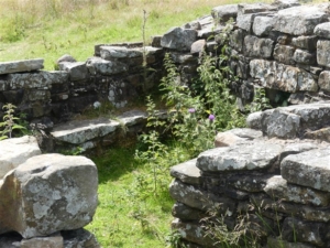 Following the path down they came across the walled enclosure that used to protect the sediment and filter beds of the first piped water supply to Mereclough and Overtown. Continuing down the drove road alongside the Shedden beck, now a cart road on the boundary between Worsthorne (to the East) and Cliviger (to the West) moors they came to a delightful stone arch bridge that took Foxstones Lane onwards to the site of Shedden Farm and across the moor to the later Cant Clough Reservoir. This was the lowest point of the walk.
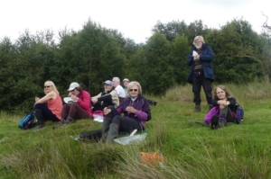 Over the bridge and up the road to the site of Shedden Farm, abandoned with the waterworks of the 1920s and completely demolished c1960 as the ruin was considered unsafe. Here the group had a welcome fifteen minute ‘elevenses’.
The map shows a pack-horse trail through the farm. This was taken back to the drove road, and following back up Shedden beck came across a sheepfold. Here hundreds of sheep could be penned prior to being washed in the adjacent dammed beck so the wool would be clean (less dirty?) for sending off to the woollen mills of Yorkshire.
A little further up the group encountered what appears to be an original kiln with the remains of staff buildings contiguous with it. Titus’ talk had shown him sat on one of the stone seats but he made no mention of what could be the best remains in the valley. It is not on a regular walking route.
Here six of the party walked back up to the carpark via a very minor path and the drove road, arriving at 12.30 and going on to a lunch at Towneley Garden Centre.
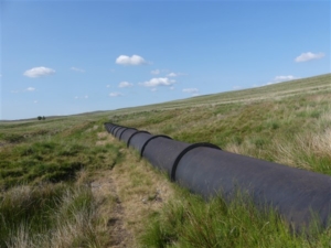 The remaining four made their way up to the large iron pipe (dated 2/6/33) that takes Shedden water across the moor to Cant Clough and Hurstwood reservoirs and along it to its source, a sediment pond on the beck known as the ‘Rec’. From here it was a short hard climb via the access track and a very minor footpath to the carpark for 13.00, to complete an interesting, informative, and very scenic walk through an incredible landscape.

