

Mills, Mines and More at Folly Clough
On a sunny Saturday 14 SPAG members left Jubilee Gardens in Crawshawbooth and walked up Goodshaw Lane, turning right at the site of Lower Folly Clough Mill, now demolished and replaced with a modern house and extensive grounds. Originally a woollen mill dating from 1785, it was possibly used for carding.1
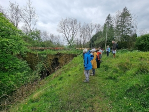
 Turning left immediately before the collapsing bridge and after stopping to hear what Rev Marshall Mather2 had to say in Victorian times:
‘…the beauty destroyed by a wall rising to a height of one hundred feet. This wall unites the banks on either side and was built as a means of transit; but why after this hideous pattern it is hard to say, when a rustic bridge would not only have served the same purpose, but cost at least a third less. At any rate, this blundering and hideous piece of engineering has cost us one of the most beautiful bits of scenery in the valley.’ Not a man to hide his feelings our Rev Mather!
Following the line of the stream, we passed the drained mill lodge before walking uphill to join the old track to Hawthorn Mill. Turning right along the route so often used by horse and cart, we viewed the ruins of the mill which had been built in 1825 for spinning and weaving, indeed in 1885 it had 11,000 spindles and 144 looms. 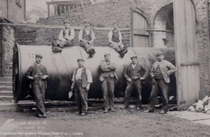 Thirty years earlier, a boiler exploded killing 6 people. Finally in 1962, the entire mill was destroyed by fire1.
It is interesting to note that this pretty valley was a favourite beauty spot, despite the mills! We decided not to continue up the valley although the remains of Greenvale Reservoir can still be seen within a few minutes’ walk but instead, carefully negotiated the stream (the bridge has long since disappeared) to head directly up the opposite bank.
Reaching a disused colliery tramway, we found much to interest us. A dismantled bridge constructed to allow livestock to pass underneath the rails, a length of chain slung between trees as a fence (see below), steps possibly leading to a pedestrian bridge giving safe access over the line and attractive stonework entrances to the culverts keeping water safely away from the foundations.3
Serving the colliery at Gambleside as well as Swinshaw, it is believed to have used an endless chain system using gravity to move heavy, filled tubs down hill and the lighter empty ones on their return journey.
We followed the line of the tramway down the field to where it entered a tunnel, passed by Folly Terrace and underneath the road to emerge in a stone lined cutting to continue its journey to the coal staithe. As we moved down the narrow path by the houses, we reflected that there were tennis courts here in the early 20th century.
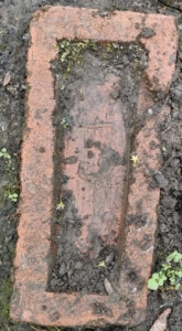 A narrow, muddy path then led us down to a rather dilapidated bridge over the cutting but we even found interest in the Accrington bricks used to repair the path. Just prior to the bridge was a mill chimney brick, narrower at one end that the other to create a circle when laid. Next, was one obviously moulded for decorative purposes with one corner removed and finally another chimney brick with a curve on its longer side.
 Finally, we arrived at what little remains of the coal staithe which produced several theories about what the layout was, although the access and assembly points for the horse and carts is still obvious. The main customer of these coal mines was Sunnyside Print works, the site of which is now occupied by Crawshaw Grange housing estate.
Here we concluded a fascinating short walk, having spent around two hours chatting, discussing and conjecturing.
1 Mike Rothwell. The industrial Heritage of Rawtenstall
2 Andrew Gill. More Victorian Rossendale Walks.
3 www.springhillhistory.org.uk
Colour photos courtesy Sue Shuttleworth
Old B&W photos courtesy Peter Fisher https://peterfisher.smugmug.com/