
Rossendale – Communication Before the Turnpikes
In 1507 Henry VII passed an Act of Disafforestation which resulted in the Forest of Rossendale becoming an attractive place, despite the poor soil, for small farmers to relocate to, resulting in a dramatic increase in population. New paths would have developed, ancient paths turned into tracks as traffic increased and new fords and bridges built.
With poor quality land, a dual economy of farming and the manufacture of woollen cloth on homemade handlooms prevailed. G.H. Tupling in his Economic History of Rossendale estimated, using Parish registers, that in the early 18th century there were around 66 locations for woollen workers across Rossendale, some with additional help for either farm duties or weaving. These would have been small family concerns involved in the carding, spinning and weaving of wool grown locally or more likely brought from the markets of Rochdale, Burnley, Bury, Blackburn and the fledgling Haslingden market.
However, wheeled transport would have been impossible in most, if not all of Rossendale due to the ground conditions. With heavy clay in the valleys and peat on the fells, packhorses would have been used to transport raw materials and finished goods. The better off would have had horses for personal use whilst the small farmer/weaver would have had to negotiate the often wet and muddy tracks on foot. Wooden-soled clogs with leather uppers would have provided cheap durable footwear which could be easily repaired. Horses walking on muddy paths would soon have made the route impassable and so causeways or causeys were constructed. These were simple large stones laid on the line of the track on which the horses walked. Packhorse trains of up to 30 animals used these tracks carrying everything from wool, woven cloth, salt, lime, coal, the list goes on.
It is now virtually impossible to trace many of these routes on the ground but old maps, particularly Yates 1768 map of Lancashire give a tantalising glimpses into past ways of communication. Bridges and fords are clearly shown for many locations, of particular importance because Rossendale is the source of the River Irwell which must have been a major obstacle to travel, even in the higher reaches. The River Ogden, Limey Water and Whitewell Brook carry large volumes of water in their own right, as do many other streams and brooks. These waterways had to be crossed if trade was to take place with the neighbouring towns of Clitheroe, Whalley, Blackburn, Burnley, Bolton, Bury, Rochdale and even Manchester or London.
Few records of bridges have come down to us from before the industrial revolution but thanks to research by A Langshaw into the Hundred Bridges of the Hundred of Blackburn in the 17th Century we learn of:
Holden Bridge Ugden (sic) Brook 1627 (presumambly lost during the construction of Calf Hey Reservoir)
Ewood Bridge River Irwell 1629
Newhall Hey Bridge River Irwell 1637.
Booth Bridge Whitewell Brook 1647.
Waterfoot Bridge River Irwell 1687.
Brandwood Bridge River Irwell 1696.
Not all tracks would lead to a bridge, although many would, but most people travelling South must have crossed the River Irwell. Rochdale was an important market and Booth Bridge, Waterfoot Bridge and finally Brandwood Bridge would all have played a part in giving access to Rooley Moor Road, the moorland route to this important centre. Holden Bridge and Ewood Bridge were on the route from Clitheroe, Blackburn and Whalley to Edenfield from where Rochdale, Bury and Bolton could be reached. New Hall Hey Bridge gave access to Bury and Manchester from Crawshawbooth, Goodshaw and Burnley. Many less important bridges would have connected individual farms, folds or villages.
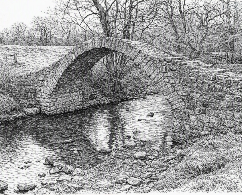
Packhorse Bridge generated by AI
We cannot be sure of the design or construction materials of these bridges but stone is readily available in the area and we have two useful clues. The first is the Diary of Dr Richard Kay where in 1748, he describes riding over a ‘stone bridge’ with his horse in the ‘highest part of the bridge’. This clearly suggests a humpback packhorse bridge but also that not all bridges were built of stone. Secondly, an oil painting at The Whitaker Art Gallery & Museum of The Friends Meeting House in Crawshawbooth shows in the foreground, a bridge of similar design. It is believed to have been painted between 1770 and 1830.
In 1698 Celia Fiennes rode to Newcastle and Cornwall and recorded details in her journal. Whilst not relating specifically to Rossendale, her narrative as she travels through Lancashire gives a real insight into what travel must have been like at this time. In a twelve mile journey from Wigan to Preston she forded shallow water by ‘many large arches…which are but narrow bridges for foote or horse’ but without which, travel was not possible after heavy rains.
Only a small percentage of available land was given over to arable farming, the majority being grassland, increasingly used for rearing sheep. Since the early 17th century, the home weaving of coarser fabrics had become more important for Rossendale farmers, with Rochdale developing as the main centre for trading raw wool and finished cloth. Fulling, dyeing and finishing processes were not carried out in the valley until the 18th century and so we can imagine that the packhorse trails would have been extremely busy transporting cloth back and forth. From the person weaving the cloth, through those fulling, dyeing and finishing it, was an intricate network of clothiers, chapmen and merchants buying and selling on long credit terms as of course there were no banks.
In the 18th century all this changed as water powered mills were developed, requiring faster, more reliable transport capable of handling rapidly increasing volumes of traffic. Roads and bridges were built to handle carts and wagons but maintaining them was, in the main, still the responsibility of the parish using traditional statute labour. New bridges would be required but the route for carts was often to the side of the causey, quickly creating a holloway as the earth was washed away. As the century progressed, the solution was to improve existing roads and develop new ones by creating Turnpike Trusts. Promoted and supported by those with a vested interest, the manufacturers, trades people and the gentry, Rossendale may have been late in introducing them but once they started, toll gates came thick and fast

