
A walk around the Lost Village of Grane
On a lovely sunny Tuesday on the 20th May 2025, ten members met in Calf Hey Car Park, built on the site of Chapel Row in the village of Grane. Its name was derived from the Norse and means a valley leading out from a longer one. Not much is left of the village, that in its heyday used to house 600 people during the 18th and 19th centuries, plus a further 900 in the surrounding area. Many people and even newspapers have reported that the village of Grane vanished under the reservoirs, but this is far from the truth as the village is situated well above and away from the water line.

Grane’s demise came towards the end of the 19th century and the very beginning of the 20th. This was due to several factors. Handloom weaving came to an end with the start of the powered mills and although there were three mills built in the area, many people had to move into the surrounding towns for full time work. When cheaper grain became more easily available from the south, farming declined, and many had to supplement their meagre earnings working in the local quarries. The nail in the coffin came, however, with the purchase of farmland by the waterboard and the building of Calf Hey and then Ogden Reservoir, the latter of which submerged Calf Hey Mill. Many farmhouses were demolished due to fears about the risk of cholera and typhoid contaminating the water.
We saw where the chapel, schools and a shop once were but we were very sad to see that the chapel cemetery gravestones were almost totally obscured by rampant bramble growth. We learnt that the St Stephen’s church on the main road, in the 1920’s, due to lack of population, was moved stone by stone to its present position opposite the Holden Arms, which now houses an antique centre and café. We walked by what was once Lane End farm to where an overgrown walled track led to Phineas Fold. The foundations of the cottages were buried in vegetation and tree growth, and only a lone gatepost could be seen. We had to imagine how beyond there, once stood a large complex at Holt Clough Farm, of cottages with loom shops, that were later turned into a joiner’s shop, grocers and a smithy, along with a notorious Ale House called ‘The Grane’. It was hard to imagine that this was once a busy thoroughfare, for shoppers, church goers and for the children attending the National School, which was situated on the main road opposite the church at Crowtrees.
After this, standing amongst the remains of Rothwell Fold, we discussed the fact that Grane and its surroundings had a reputation for making illegal whisky, so much so that for fourteen years from 1834 to 1848 an Excise Officer was stationed in the Haslingden area. They were known as Whisky Spinners or Graners. We learnt that several farmhouses around here, with Rothwell Fold being one of them, were found to have been producing a large amount of whisky for many years prior to detection. When discovered, some heavy fines and long sentences were given out at the time when Daniel Thwaite of Thwaites Brewery fame was a magistrate.
We made our way out of the village towards the Hamlet of Hartley with lovely views above Calf Hey Reservoir. It was interesting to investigate the well preserved foundations of three farmhouses and cottages together with their wells. The buildings were demolished in the 1960’s for health and safety reasons, but the foundations were excavated and preserved in the 1980’s for us to study today. After a break for elevenses, further on we came to another interesting preserved site of a large farmhouse called Lower Ormerod’s, with its loom shops. Much debate was made of what was where, when studying photographs of it as a ruin in the 1940’s.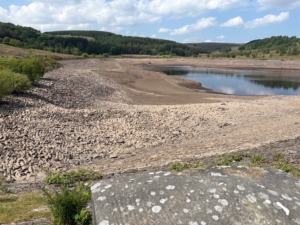
From there we had a leisurely walk in the glorious sunshine, around Calf Hey reservoir which was extremely low, after a dry winter and a month with virtually no rainfall.
Afterwards a few of us drove to Clough Head Car Park to take advantage of lunch at the friendly little café.
